Ban Mae Sam Laep: Explore Authentic River Life

Journey to Ban Mae Sam Laep and immerse yourself in the unspoiled charm of a border community where nature meets tradition.
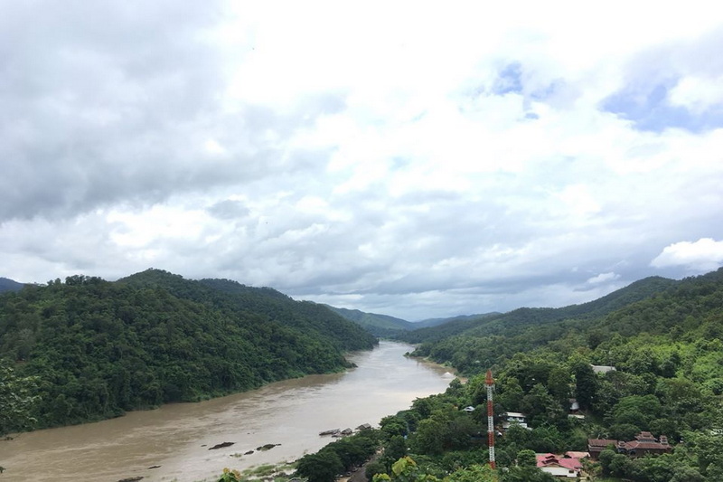
Ban Mae Sam Laep is a village and sub-district in Mae Sariang District, Mae Hong Son Province, Thailand. It’s situated along the Salawin River, which forms a natural border between Thailand and Myanmar. This area offers a wealth of fascinating details regarding its geography, climate, people, and culture, as well as its tourism potential.
Geographic Information
Ban Mae Sam Laep is nestled within a complex mountainous terrain, traversed by several significant rivers: the Salawin River, Moei River, Ngao River, and Yuam River. The Salawin River is the heart of this area, serving as a crucial transportation route and a rich source of natural resources. Most of the region is covered by dense forests, particularly teak and Dipterocarp forests, forming part of Salawin National Park and Mae Ngao National Park. The landscape features hills and valleys, offering beautiful scenery and high biodiversity. However, land travel, especially during the rainy season, can be challenging due to some unpaved roads and potential landslides in certain areas.


Climate Information
Ban Mae Sam Laep experiences a tropical savanna climate with three distinct seasons:
- Hot Season (March-April): The weather is hot and humid, with temperatures potentially soaring to 36-38 degrees Celsius.
- Rainy Season (May-September): Influenced by the southwest monsoon, this season brings heavy rainfall. The sky is often cloudy or overcast almost constantly, with July typically being the cloudiest month.
- Cool Season (October-February): The weather is pleasantly cool to cold, especially during mornings and nights. Temperatures can drop below 15 degrees Celsius, and dense fog may occur on some days.
Local People, Ethnicity, and Culture
Ban Mae Sam Laep boasts a rich diversity of ethnicities and cultures. The population comprises various ethnic groups living together harmoniously, with the main groups including:
- Karen: A prominent ethnic group in the area, with various subgroups like Pwo Karen and S’gaw Karen. They have largely preserved their customs, way of life, and language, often residing in higher elevations and practicing agriculture.
- Shan (Tai Yai): Their culture and language significantly influence Mae Hong Son, including Ban Mae Sam Laep.
- Central Thai:
- Other Minorities: Such as Lahu, Lisu, Hmong, Lahu, Lisu, Hmong, Lua, Burmese, and Haw Chinese (Yunnanese Chinese), who have migrated to the area and integrated their cultures.
- Religions: People in the area practice diverse religions, including Buddhism, Christianity, Islam, and animist beliefs, all coexisting peacefully.
The distinctive culture is reflected through:
- Languages: Local dialects and ethnic languages are used alongside central Thai.
- Dress: Each ethnic group has unique traditional attire.
- Food: Local cuisine is diverse, blending culinary traditions from various ethnic groups.
- Traditions and Festivals: Events are organized based on the beliefs and lifestyles of each tribe, such as harvest ceremonies, ordinations, and merit-making festivals.
- Architecture: Elevated wooden houses with thatched roofs are a common and characteristic sight.


Tourism Information, Key Attractions, and Activities
Ban Mae Sam Laep is not yet widely known to international tourists but is an appealing destination for those seeking an authentic rural lifestyle and pristine nature. Tourism here focuses on nature and cultural adventure.
- Salawin River: The most prominent feature of Ban Mae Sam Laeb. River trips along the Salawin are a popular activity to admire the beautiful scenery on both banks, observe the riverside lives of locals and ethnic groups, and travel to villages deeper in the valleys or even cross to the Myanmar side (permits and border situation should be checked).
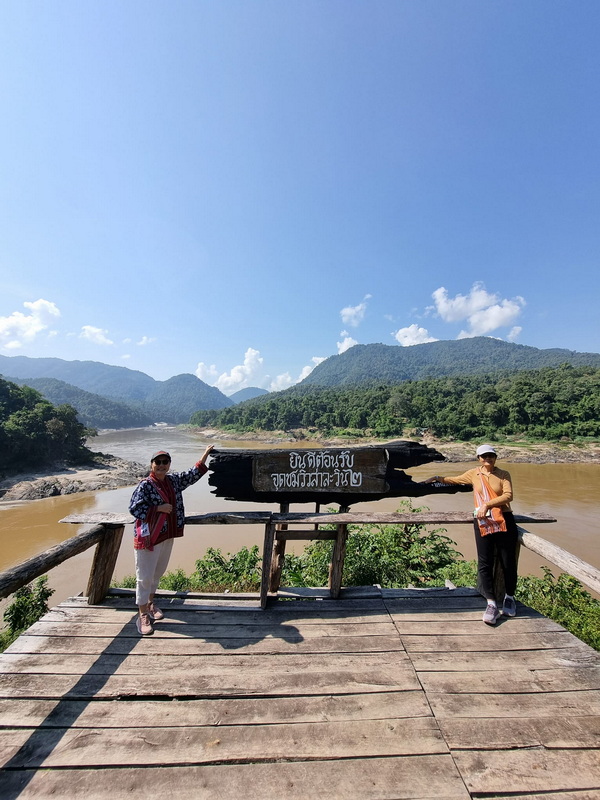
- Phra That Mae Sam Laep Viewpoint: This spot offers expansive views of the Salawin River and the surrounding area, especially beautiful at sunrise with sea mist. The ascent may involve a short hike.
- Riverside Villages and Border Market: Interesting places to observe local life, trade local products and goods from Myanmar, and sample local food.
- Salawin National Park and Mae Ngao National Park: Located nearby, offering activities like nature trails, waterfall viewing (e.g., Olohkoh Waterfall), and bamboo rafting on the Mae Ngao River.
- Ethnic Lifestyle: Tourists can learn about the cultures of the various ethnic groups in the area, such as weaving, traditional cooking, and participating in local ceremonies (if opportunities arise and permission is granted).

Getting to Ban Mae Sam Laep
Traveling to Ban Mae Sam Laep can be challenging but is an integral part of the memorable experience. The main routes are as follows:
From Mae Sariang Town:
- Public Transport/Songthaew (Shared Taxi): Songthaews depart regularly from Mae Sariang bus station to Ban Mae Sam Laep daily (service might be infrequent, so it’s advisable to check schedules beforehand). The journey takes approximately 2-3 hours, depending on road conditions.
- Private Car/Rental Car: Take Highway 108 from Mae Sariang, heading south. At the Ban Mae Sam Laep intersection, turn left onto the local road (Rural Highway MS.3005). This road is paved in some sections and gravel in others. The route is quite winding and steep, especially during the rainy season, when potholes and mud are common. Therefore, a 4×4 pickup truck or a high-clearance vehicle with good performance is recommended. Drivers should be experienced with such routes.
Precautions:
- As this is a border area, research and inquire with local authorities about any restrictions or safety concerns before traveling.
- Road conditions during the rainy season can be challenging; use a vehicle suitable for off-road routes.
- Respect the local culture and traditions.
Ban Mae Sam Laeb remains a hidden gem in Mae Hong Son Province, waiting for nature and culture enthusiasts to discover its unique experiences.


Leave A Comment